Geozones
The Geozones tab displays the list of the company's geographic zones and controls their display on the map. Geozones are used to monitor entry and exit, to limit speed on a section, and in reports. When a geozone is selected, the map centers on it, and its description is shown below the list.
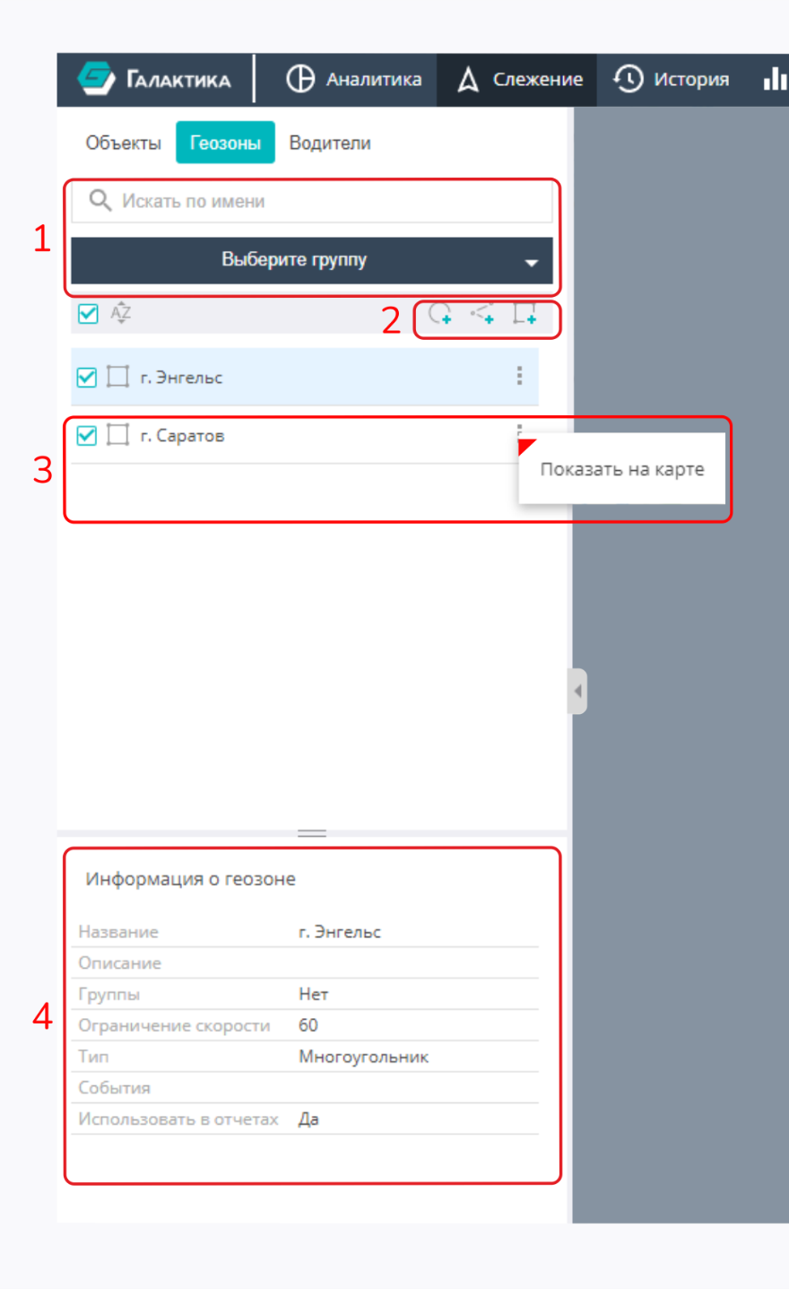
The illustration highlights: 1 — geozone search and grouping; 2 — quick geozone creation; 3 — geozone context menu; 4 — card of the selected geozone.
Search and filtering
- Search by name — the box above the list filters geozones by name as you type.
- Filter by groups — a drop-down list with its own search box lets you keep only the geozones of the selected groups.
- Sorting — a toggle for the list order (A→Z / Z→A).
Display on the map
The checkbox to the left of each geozone turns its display on the map on or off. The checkbox in the list header selects or clears all geozones on the current page at once. Geozone names on the map are turned on with a separate button on the map itself.
Creating a geozone
If the user has the permission to create geozones, the list header provides three add buttons — by the type of the zone geometry:
- Point (marker) — a zone as a point on the map;
- Line (route) — a zone along a polyline;
- Polygon (area) — a zone as a closed area.
After a type is chosen, the geozone is drawn on the map, and then a dialog with its parameters opens (see Geozones in the Control panel).
The create buttons are visible only with the appropriate permissions: administrators
(EDITUSERS / EDIT_ALL_USERS) or users who have been granted the geozone-creation right in a
container. Without these permissions the tab is view-only.
Geozone context menu
A context menu is available for a geozone in the list:
- Show on the map — center the map on the selected geozone.
Geozone card
When a geozone is selected, its card is shown below the list with the following fields:
- Name;
- Description;
- Groups the geozone belongs to;
- Speed limit — the threshold for detecting speeding inside the zone;
- Type of the zone;
- Events — which events/alarms the zone produces (entry, exit, etc.);
- Use in reports — whether the geozone participates in reports.
List navigation
A long list of geozones is split into pages — pagination at the bottom of the panel is used to move between them.